Merging


Manifesto

The City is a crucial mechanism for the functioning of today’s society. The Global City is that piece at the core of the world’s economical machine. It produces fuel, power and flows which serve all the different dynamics happening simultaneously all around the world. But the City is not an abstraction per se, it is not existing only because of the idea we have of it, it exists because of the people who make it. That mechanism, that flow of product, coin, and information, is moved by the hands and brain of millions of individuals which deserve to take a piece of that wealth and abundance that cities own because of them.

Migrant workers have been a fundamental force for the economic and progressive success of the Great Bay Area and its positioning in the World’s market. While being the essence of growth, they were placed at the bottom of society, outcasted in Urban Villages and exploited by manufacturing industries. Nowadays advances in technology threaten their work opportunities even more; when automation is going to be the norm, how is the floating population going to be integrated in the job market?

This maltreatment of the workers is shared by the natural deltaic environment, also overburdened by the industries and fast urbanization. The water is seen merely as another tool for economic gain, mountains and hills are a limit to overcome.

The Global City should be the City which grows together with the people who make it. It should welcome Nature; it should acknowledge it as the missing link of the mechanism. It should give space to the businessman and to the bus driver, to the engineer and the farmer, to the politician and the janitor. It should give good work and life conditions to all.


The Team

Francien Fons is a Dutch student who obtained her BSc in Architecture at TU Delft. Currently she is studying Urbanism (master’s degree). Her interest are mainly urban sociology, spatial planning, and landscape. She is very interested in China and with this course she hopes to get a deeper understanding of the Chinese planning context and culture.

Isabella Trabucco holds a diploma in Arts and Design obtained in Venice, a BSc in Architecture from TU Delft and is currently completing her MSc in Urbanism. Isabella is pursuing the goal of becoming an urban designer focusing on social justice on one hand and sustainability and water landscapes on the other.

Yuru Chou is a Taiwanese student with a bachelor’s degree in landscape architecture. Regenerating and reinvigorating disregarded brownfield lands and old city centres with ecological sustainable approaches are her interested focus. She is impressed by systematic mechanism on planning and designing for a climate-adaptive, sustainable design realm in Dutch landscape.


Yan Liang comes from Mainland China. Her bachelor is from Landscape Architecture in Tongji University, and she is pursuing a master’s degree of landscape architecture in TU Delft currently. She is fascinated by urban landscape, metabolism systems and policy powers hidden behind different culture backgrounds.

Xinqi Yao got her bachelor's degree in Landscape Architecture in Mainland China. She now transferred her interest Into urban field for a master degree in TU Delft. With an interdisciplinary background, she is now pursuing deeper understanding and insights into urban renovation, metabolism landscape and social justice, as she pays extra attention to societal vulnerable groups.


The Quest

The target group

"Those people who travel beyond a certain limit, leave their registered permanent residence temporarily, and travel to and from their homes on an irregular basis. It includes temporary residents (including those who have temporary residency permits for six months or longer), those who travel to and from on the same day, and those who change trains on the way."

(D. Li, 1994)

Work condition and opportunities

"Rural migrant workers account for a large proportion of the work force in manufacturing and construction. The 2000 Census data indicate that 68 per cent of all jobs in the manufacturing sector and 80 per cent in the construction sector were filled by rural migrant workers."

(Research Office Project Team, State Council, 2006)

"The majority of migrant workers face considerable insecurity in terms of employment, income, social protection, and access to education for their children. Their housing conditions are much worse than those of local urban residents, and even worse than those they would have experienced in their place of origin if they had not migrated. "

(L. Shi, 2008)

Life condition inequality and vulnerability

"Among other elements, disaster preparedness and management plans are vital components of an adaptation strategy. But to design these, we need a better understanding of which people and systems are vulnerable to what kind of climate hazards; also, what makes them vulnerable and where they are located."

(A. De Sherbinin, A. Schiller, & A. Pulsipher, 2007)


The Challenge

How can we make the floating population land and stabilize in the GBA?

How can we improve the work and life condition of the floating population?

How can the natural environment be included in the transition towards a service-based economy?


The Game

Polycentric model

The first iteration of the gameboard explored three different scenarios of placement of villages and industrial zones: the concentric, eccentric, and polycentric model. After the SWOT analysis done for all the different models, we decided to explore further the case of polycentrism.

Improving the life and work condition

Our main intention throughout the project is to provide the opportunity for the floating population to stay long term in the GBA. Due to prior analysis, we understood that currently this group is not well integrated in the urban tissue, but is rather settled in isolated urban villages. In addition to that they also are not provided with equal opportunities and conditions as other residents. With the 2nd game board iteration we explored what it would mean for the region to add new targeted educational, leisure and health facilities in the most vulnerable areas. Furthermore, we saw that currently, there is a strong trend of shift from manufacturing towards hi-tech and service-based economy, so we played with the same rules.

Mobility

In the 3rd Iteration we decided to broaden our focus to mobility because we understood the importance of connection between different centres in the GBA. Mobility knots which target ones again the improvement of the condition of migrant workers, are placed following strategic rules. These knots are not just logistic points, but are enriched multifunctional locations.

Multifunctionality

In the 4th and 5th Iteration we further exploded the dots on the grid. The functional clusters which were covering a 2x2 grid now become a set of 9 points instead. This way we were able to understand better the overlaps between functions, mobility, and urban villages. In the end, our core idea is that this overlap of functions and thereby the multifunctionality of these areas at regional scale, could enhance and improve the quality and prosperity on the local scale too. Via this principle, we were able to select the areas in the GBA which are most crucial for the floating population but also have the most potential in terms of functional mix. The rule for selecting these areas was as follows: a mobility knot needs to be surrounded by at least 3 out of the 5 types of functional clusters; if this were the case, the city containing this model would be taken into account for further design and research.


The Vision

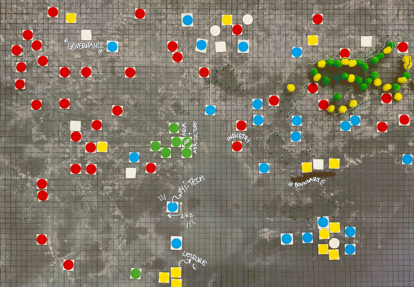
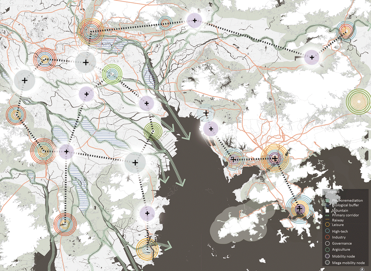
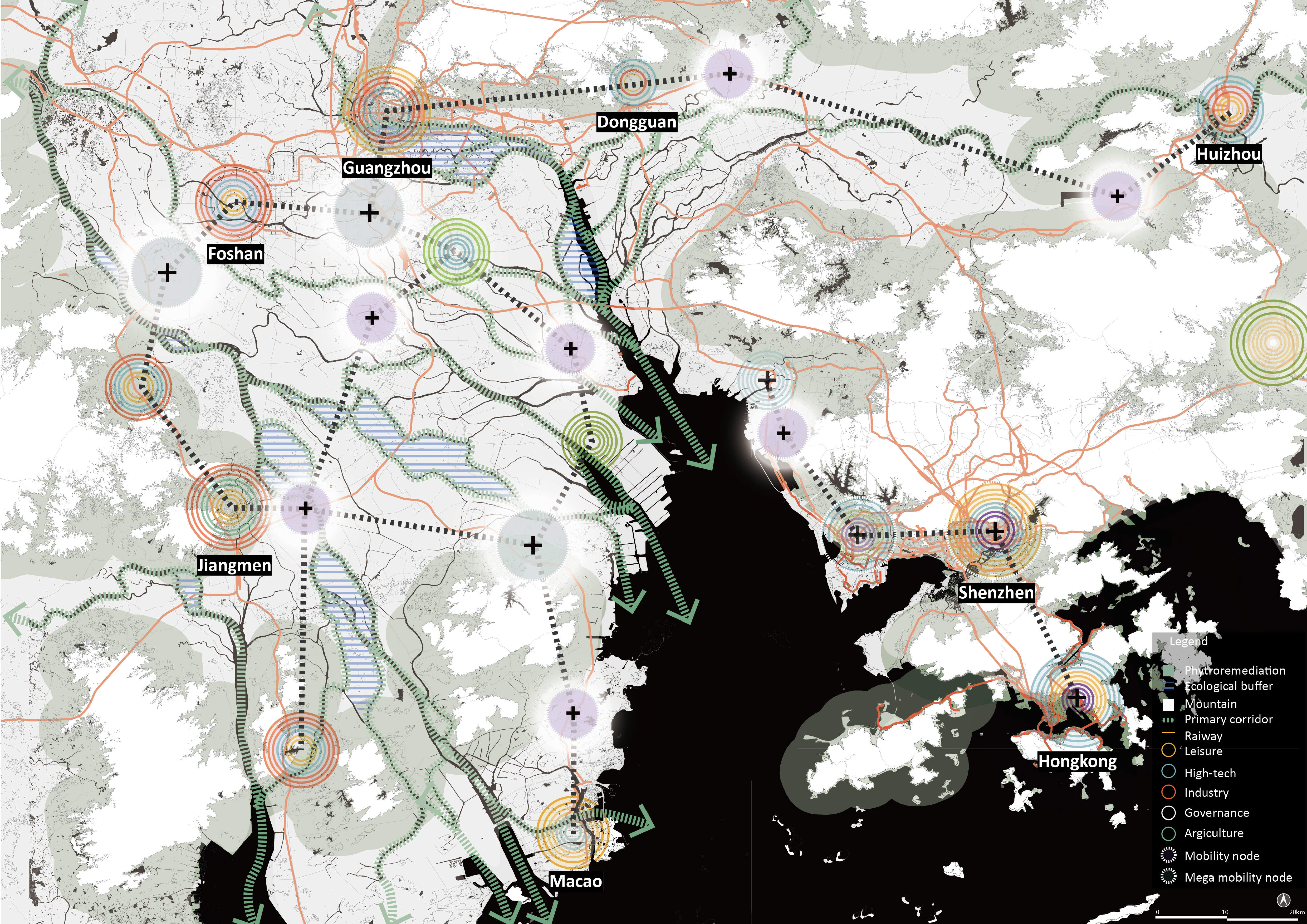
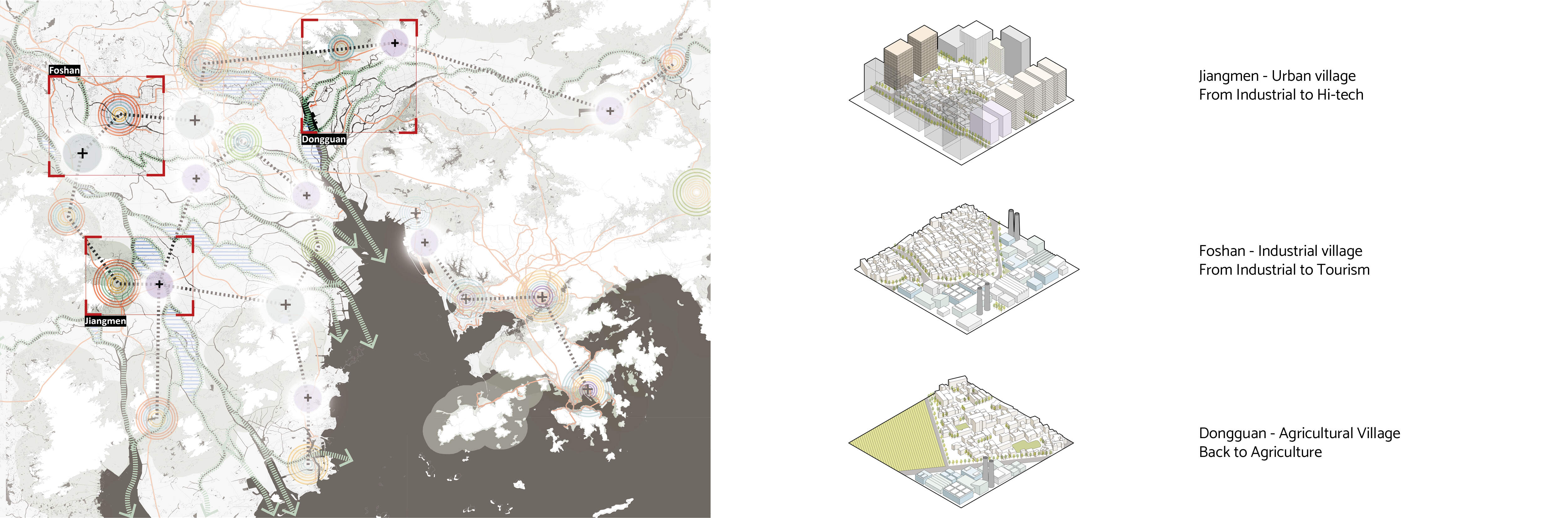
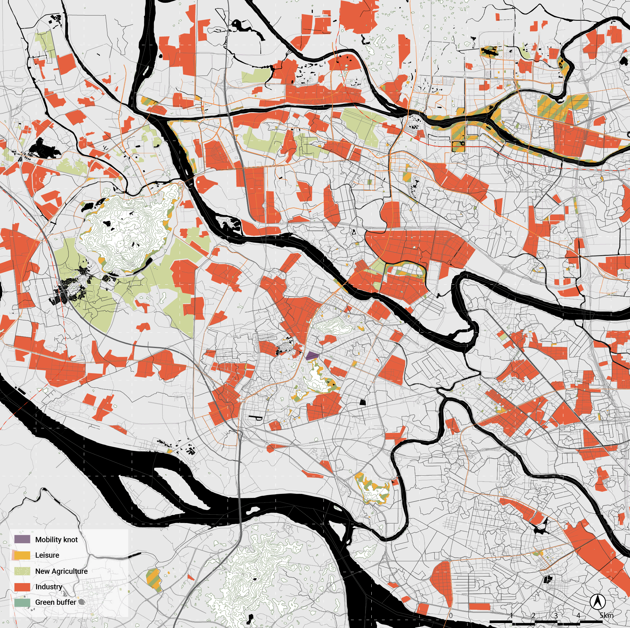
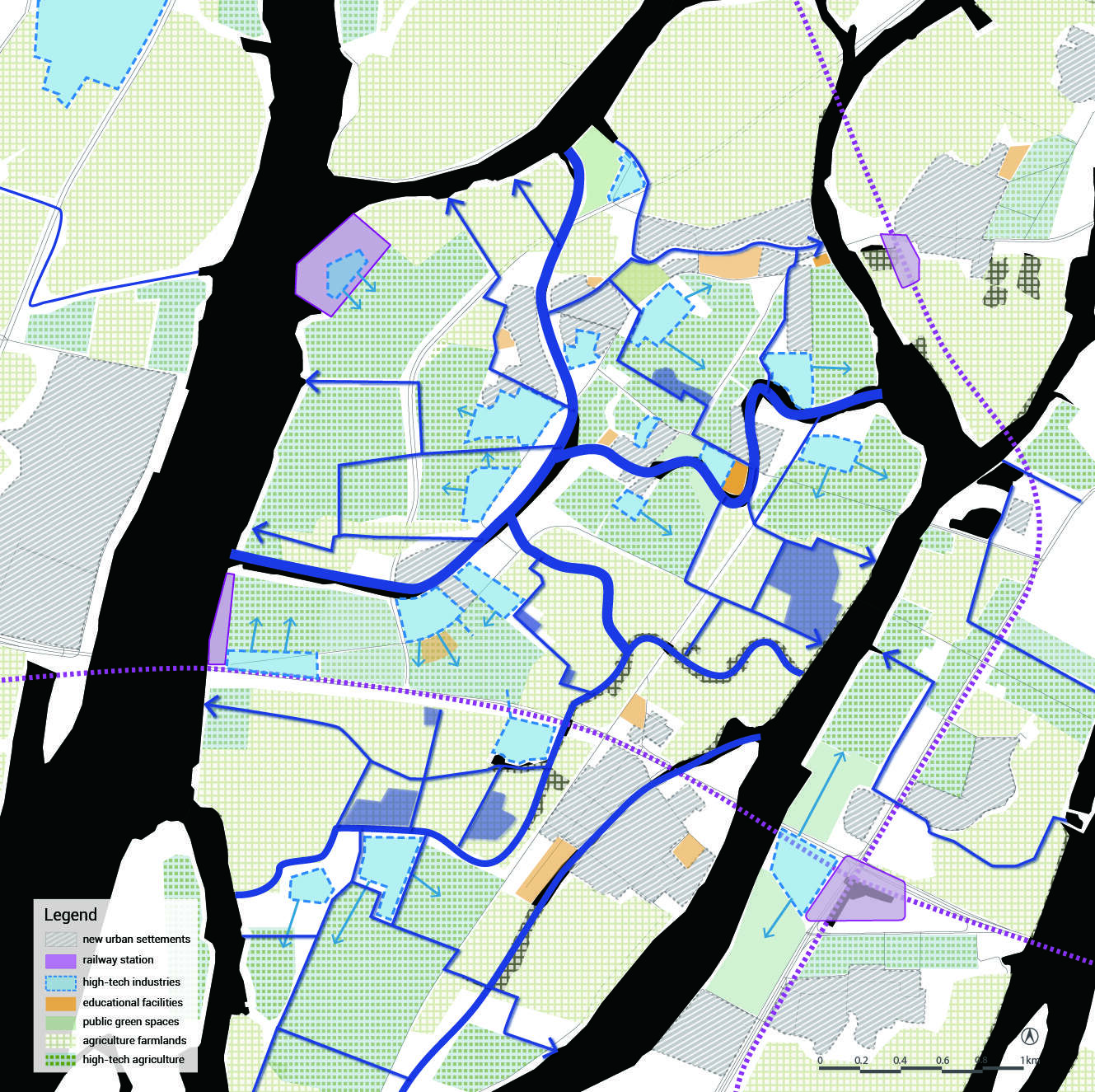
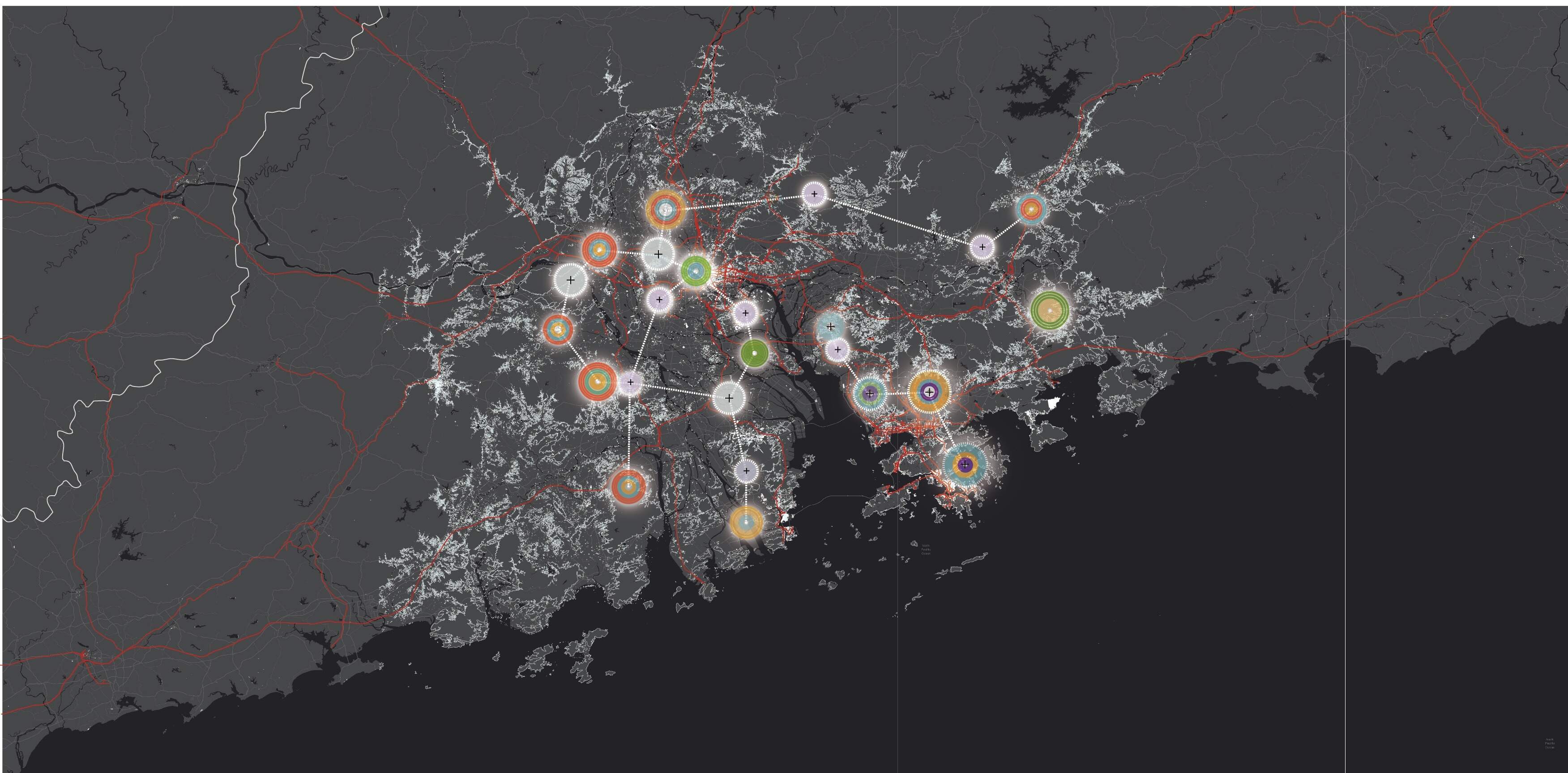
In the vision map come together all the different principles needed to ensure a polycentric regional model with focus on the floating population and the delta environment.

The points in the vision represent the different functional clusters. They contain: Industrial, Governance, Hi-Tech, Agricultural and leisure functionalities. The points expand going through the scales. To understand the complexity of the regional scale we need to look for abstraction, while looking closer we can see more clearly the system dynamics and tackle them more effectively.

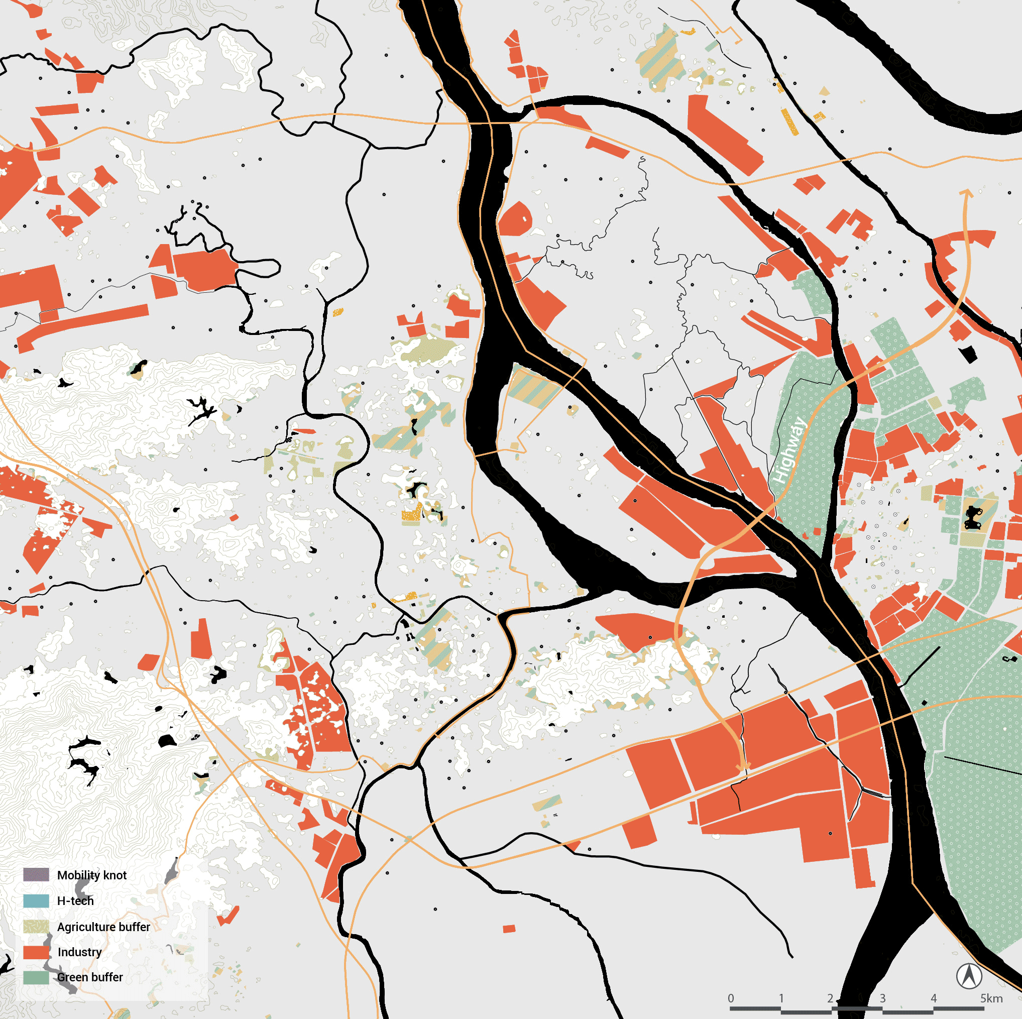
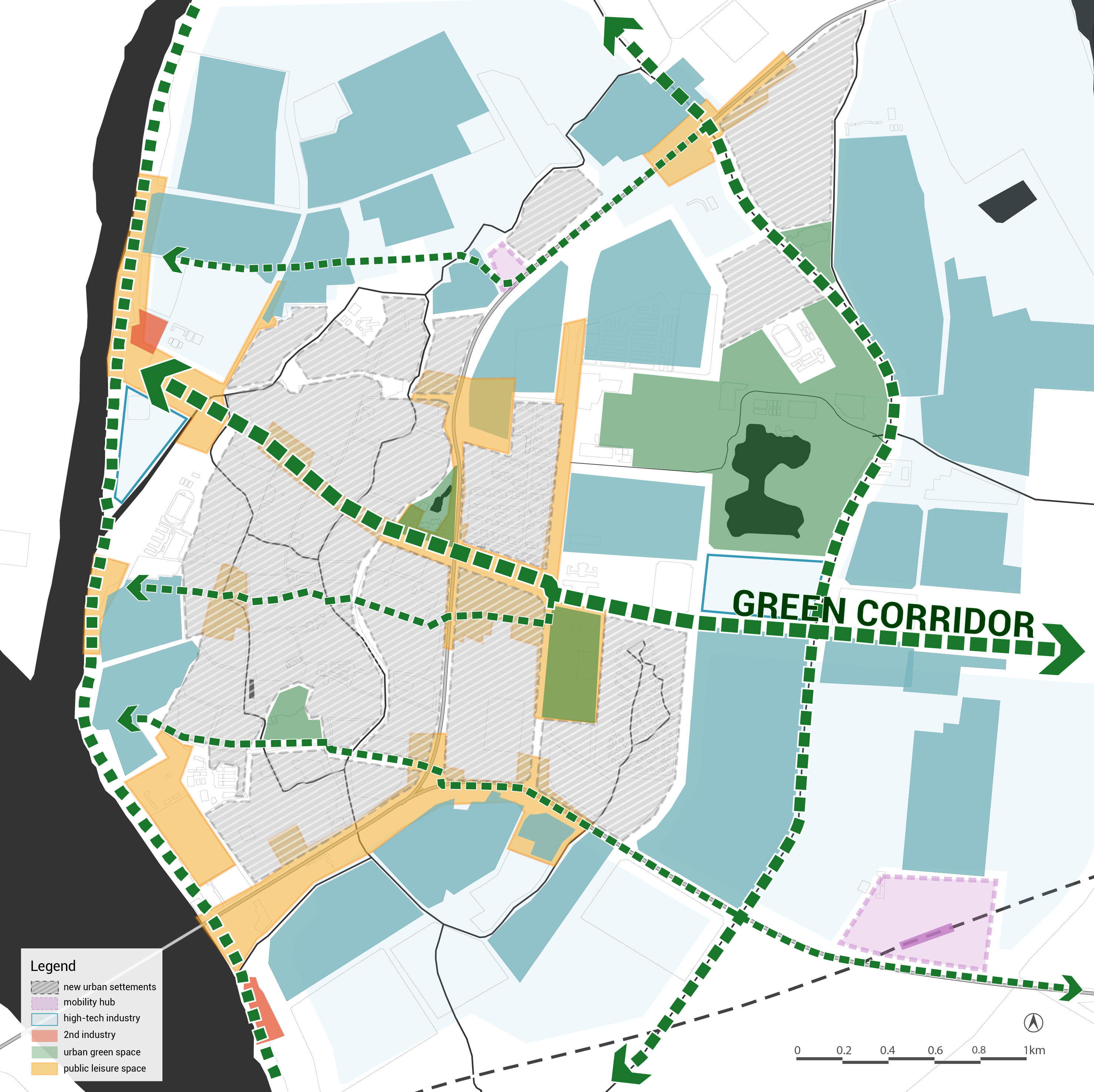
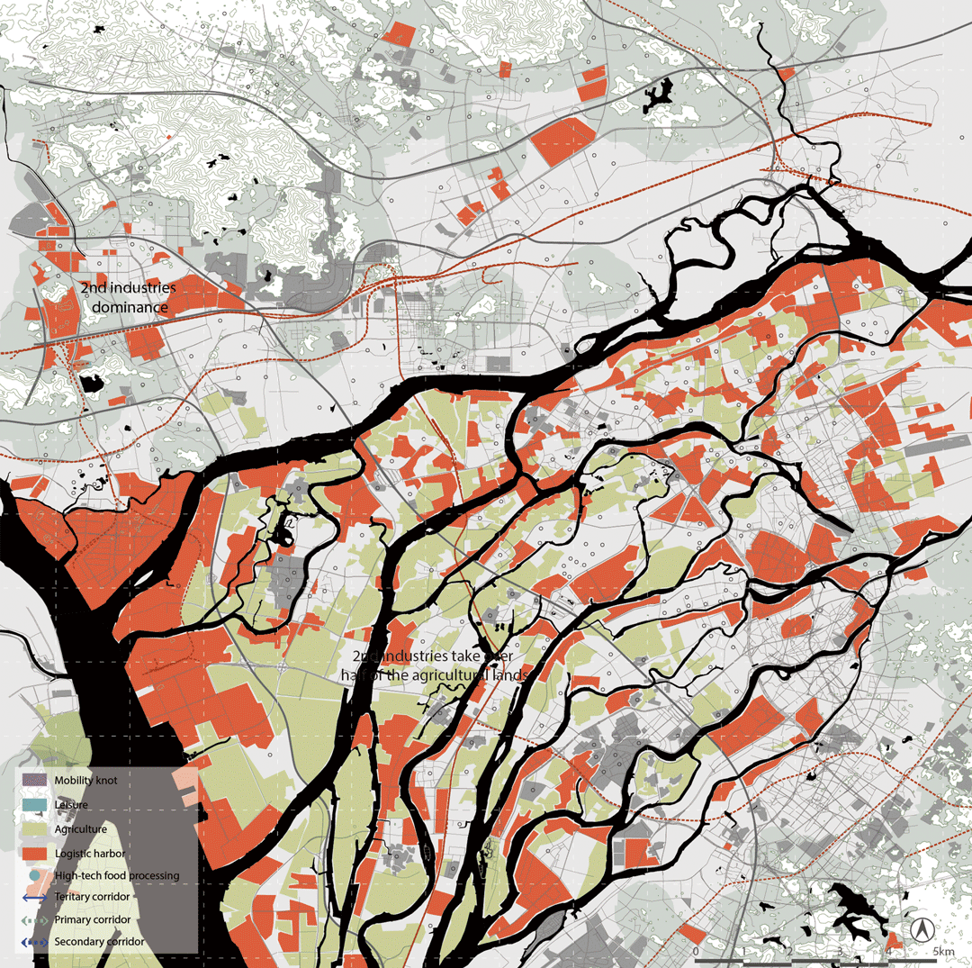
The Ecological corridors also act through the scales. At the regional level we see the primary ones, dictated by the main waterways. The secondary ones appear in the meso scale, connecting the primary ones with each other. At the micro scale, the primary, secondary and tertiary come together and activate the intervention locations in different ways. Tertiary corridors mainly connect the secondary ones with each other: doing so they also directly influence the villages' public spaces, environment and even pattern of urbanization.

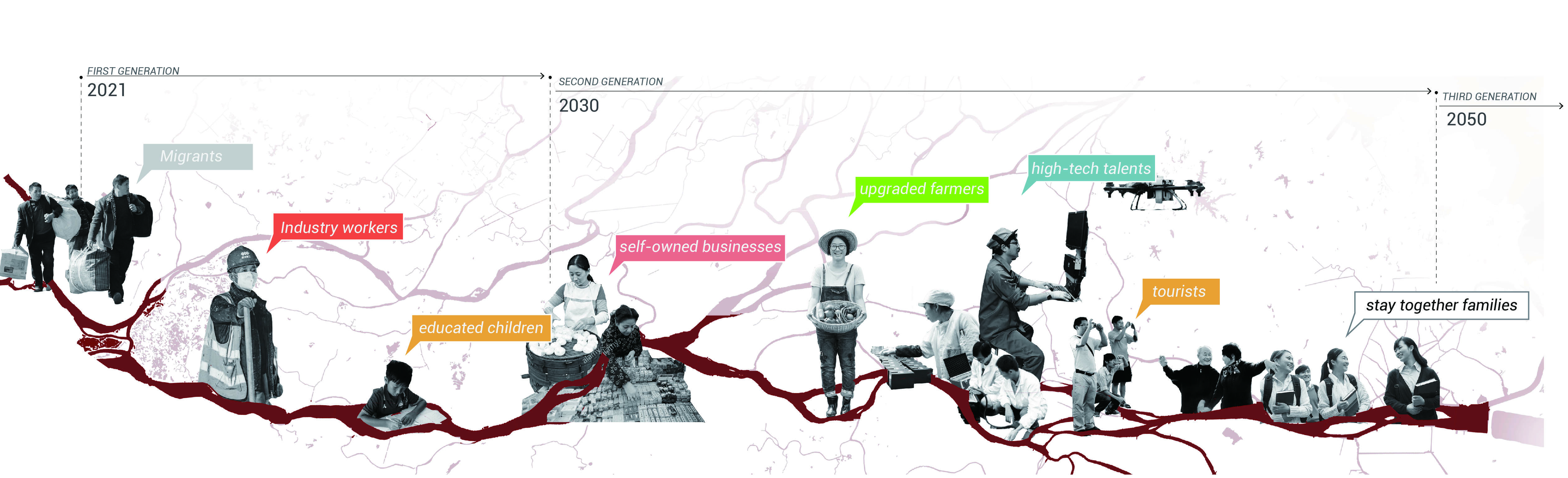
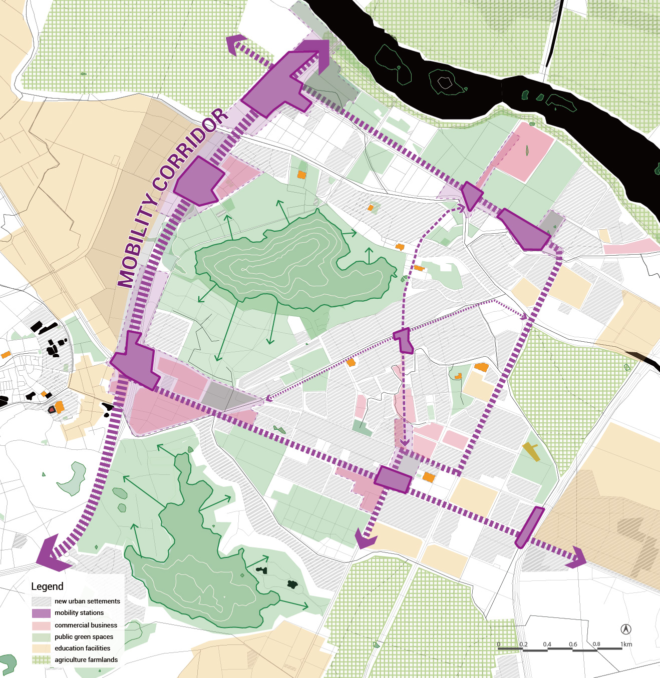
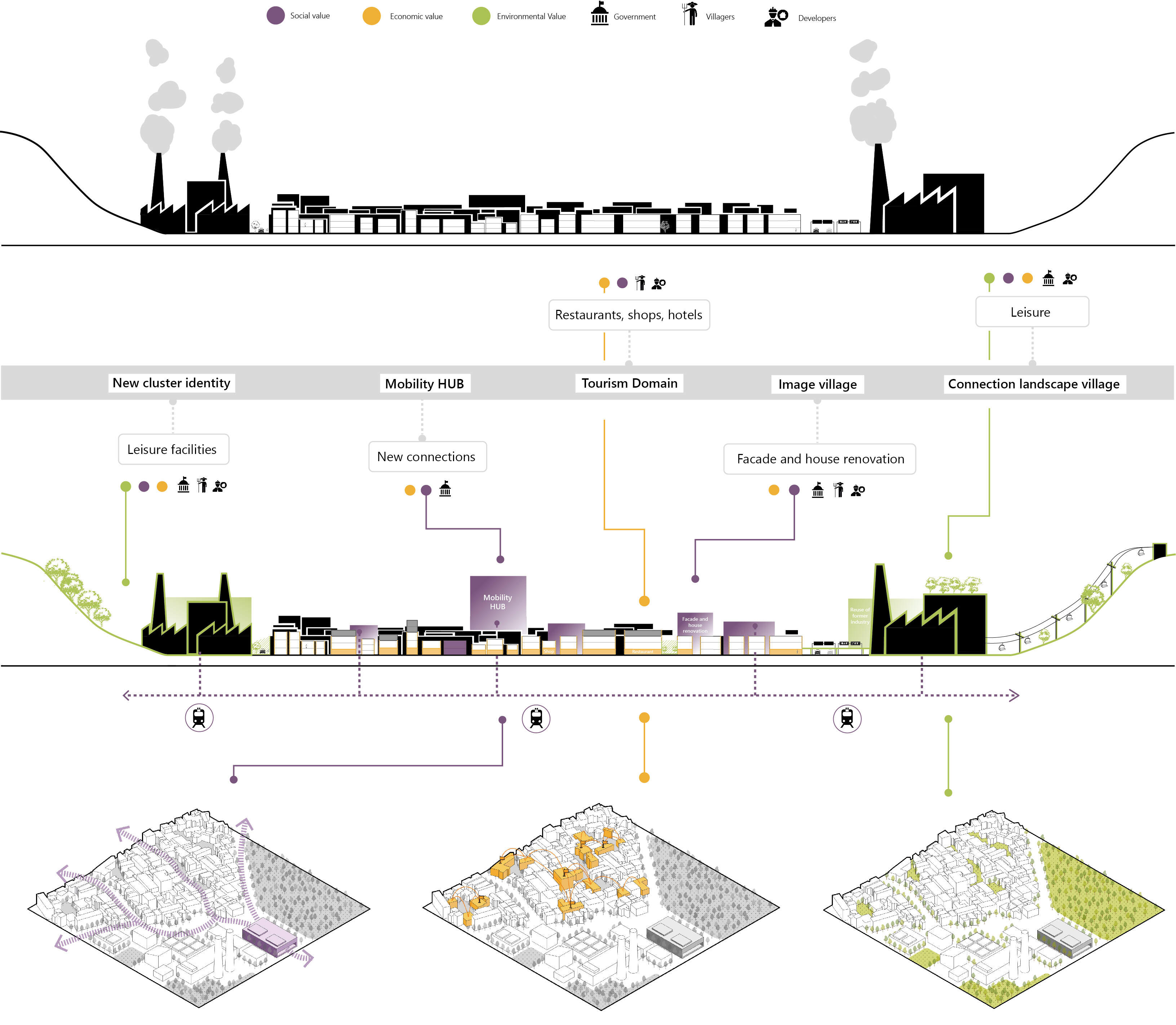
The Mobility knots are also at the core of the vision. Public transport is crucial for migrant workers. The small sized mobility knots are mainly logistic points which facilitate the workers to move more freely between the urban centres (now mobility is concentrated in the centres themselves). The big mobility knot is a conglomerate of supporting functions beside logistic points. Its placement augments the attractiveness of certain areas and activates a process of improvement of life conditions for the migrant workers, with new health, education, and leisure facilities.

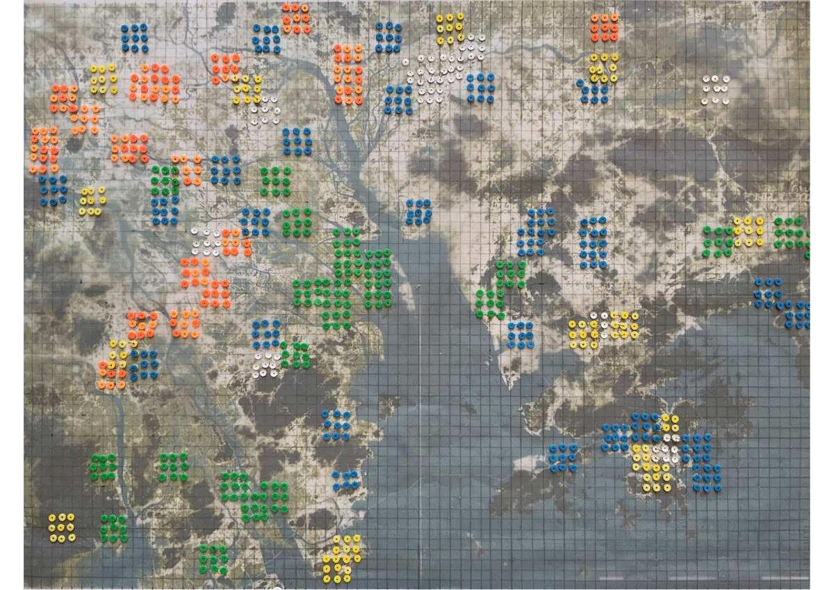
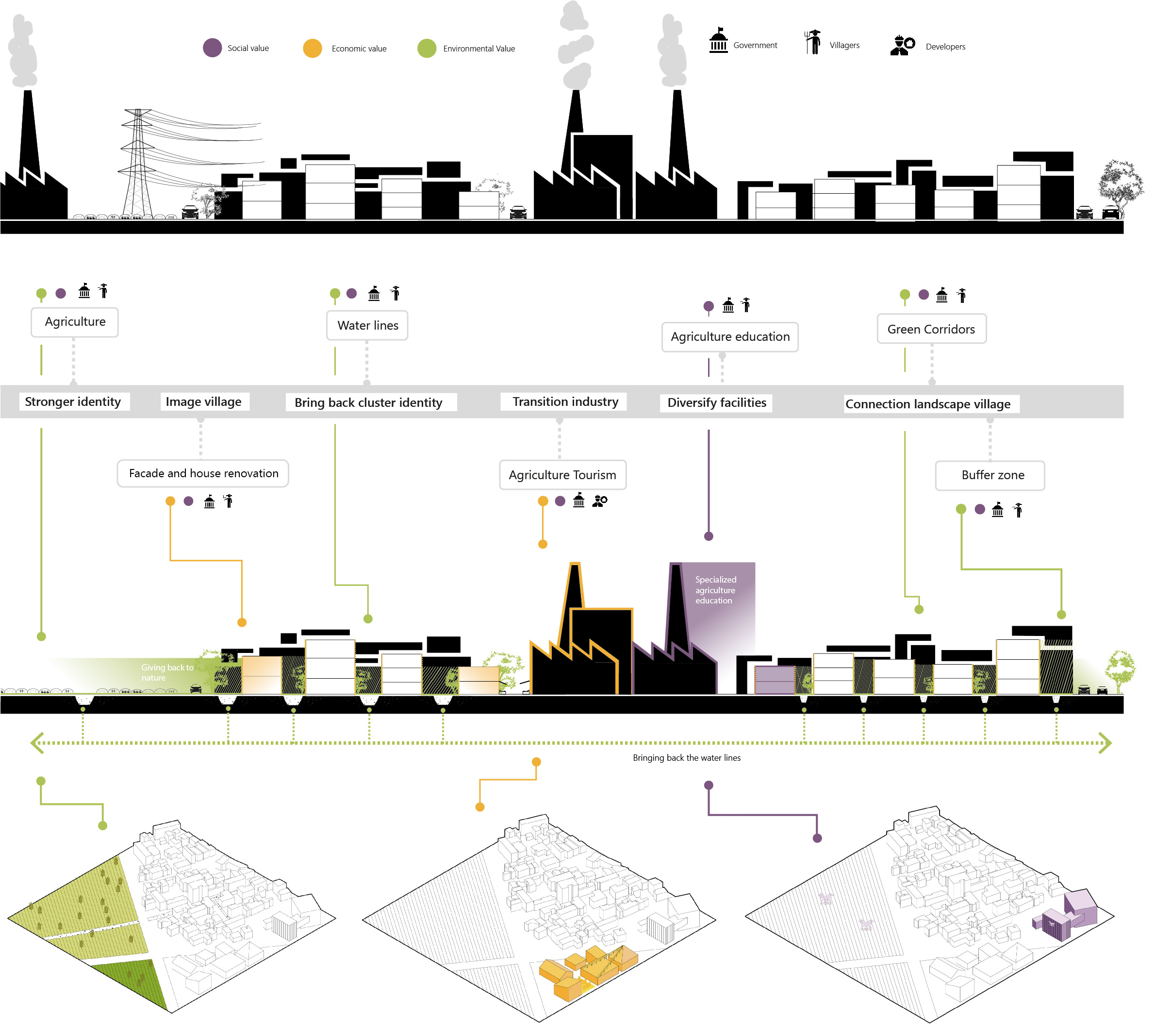
The regional vision strategies are done through the focus on the floating population. As made clear in the analysis and the gameboard, multifunctional clusters can offer more job opportunities and improved life conditions for the migrant workers. The dots and the mobility knots in our vision try to offer that, while creating a healthier environment through the eco-corridors.

The locations

Timeline of the life of migrant workers.

Jangmen - From Industrial to Hi-tech

Jiangmen is the location which contains the first typology of village: the urban village. This type of residential conglomerate is usually the oldest; here live former farmers who got involved because of governmental action in the housing development market. The village is surrounded by high rise, with very cramped streets that divide the buildings where air and light are hardly getting through.

In the meso scale it is possible to notice that even though the area is very urban, the hills and the waterways (eco-corridors) are still very dominant. In our vision we consider a buffer zone around the contours of these natural elements. This means that all the manufacturing industries which are falling inside this buffer, need to be converted. From our gameboard we already chose that the identity of Jiangmen should be defined by hi-tech. This is because the urbanization is already quite high and a transition towards the hi-tech could lead to a better business connection with the east side of the GBA.

Furthermore, a small mobility knot was placed next to the selected village in the gameboard iterations. This allows us to identify the highway, railway and bus route which need to be strengthened. The highway just above the village is also overlapping with a tertiary corridor which works as a green buffer between a primary and secondary corridor.

The Urban village at the meso scale works as a catalyst for the transition towards hi-tech industry. The green corridor which connects the new hi-tech with the high-rise residential buildings through the village is the main purpose of the new public spaces. These expand in the small streets and are causing improvement on the atmosphere and condition of the place.

Three types of values and three types of stakeholders are involved in micro scale interventions. New targeted educational facilities are added in the village, because of the lack of space, the current stock is used. Because of this the residents can get compensation: they can acquire a new house on the new expansions, and they can also earn a community commercial/business space. Just right after this process, the villagers themselves can improve their common space. We think that giving them the opportunities to improve their life condition is a great asset for the creation of an inclusive community and of identity. If the migrant workers can recognize a place as theirs, they will be more attracted by the idea of staying.

Sketch Jiangmen current and future situation.

Foshan - From Industry to Tourism


The second location considers the Industrial Village. Most of the land use in this area is indeed dedicated to manufacturing, enclosed within wide waterways and sparse hills. In the gameboard we located here the big mobility knot. We enhance the multifunctionality of the cluster by making stronger mobility connections. We add a new railway which passes right through the knot and the Industrial village location. The main goal is to stimulate tourism in this area, by adding cultural activities, caring about natural sites, entertainment but also education and business. Because we think that this considerable intervention is going to attract even more residents, we locate a new residential cluster on the south-east side. Leisure zones are highlighted by the river branches, together with the hillside. In this case our focus is to limit the manufacturing and we do so by converting the industry buildings to leisure or mobility facilities or in natural or agricultural sites.

On the micro scale it is possible to notice how the whole industrial village is activated by the augmented connectivity. The hillside is improved and is given back to nature, more commercial and touristic business can be added at the ground floor of the village’s buildings.

In this case the intervention has a more top-down approach since the construction of a new railway needs great investment by the public domain and the integration of touristic attractions needs a strong presence of the market.

Sketch current and future situation.

Dongguan - Back to Agriculture

For the case of Dongguan, we expected to find a mere agricultural village, instead we found something more interesting. We noticed how on the meso scale the patterns of urbanization are really dictated by agricultural irrigation patterns, but at the same time the manufacturing industry is strongly taking over.

At this location we see the relationship with a wide part of the river and the primary corridor which runs towards it is a considerable border. Our intention here is to keep the producing identity of this place but change the trajectory to agriculture. We do so but simply bring it back while supporting it with innovative business clusters close to the mobility knot and the hills, while keeping the harbour identity towards the wide water corridor. We envision an agriculture production which is sustainable and technologically advanced. A place where people from around the world can come and get inspired by the ecological attention and efficient production of edible goods.

In the micro scale we see that the tertiary eco-corridors are highlighted. In between waterways and farmlands, the villages can thrive. New professional schools and green public spaces are improving the life condition and the job opportunities for the migrant workers.

Sketch current and future situation.


Staying in the GBA

Our polycentric vision for the Great Bay Area has at its core the floating population. Using multifunctionality, connectivity and ecological interventions, we tried to actively include migrant workers in society and in space. The different clusters work together towards the goal of inclusion of all people and a healthy transition to new technological advancements and market trends. We want to not let the migrant workers behind when automation becomes the norm, we want to make them stay and make them feel part of the place. The floating population is a part of the mechanism of the Global City and so the floating population is the Global City.