ECO-librium


Manifesto

“Arrogance hurts, modesty benefits. Benefit goes to the humble, while failure awaits the arrogant.“ Is an old Chinese saying that is deeply rooted in the culture. By building upon economic growth this value has been forgotten which led to an increased vulnerability of the people and the environment. Overexploitation and over commodification of natural systems results in a diminished adaptive capacity - necessary for the balanced development of the region. Therefore, leading to rapidly growing risks of biodiversity loss and the disruption of the natural environment, resulting in pollution and health disparities. Due to the rapid urbanisation, there are increased flood risks, which influence the coastal population of the GBA further, expanding the socio-economic inequalities in the area.

By empowering weaker aspects and humbling the overpowering a new dynamic equilibrium shall be reached. Therefore, enabling a process of evolutionary resilience will over time create the conditions to cope with the effects of climate change and the interrelated societal challenges. Giving space back to nature will diminish the vulnerability of the system. This is achieved by empowering the three carriers of change.

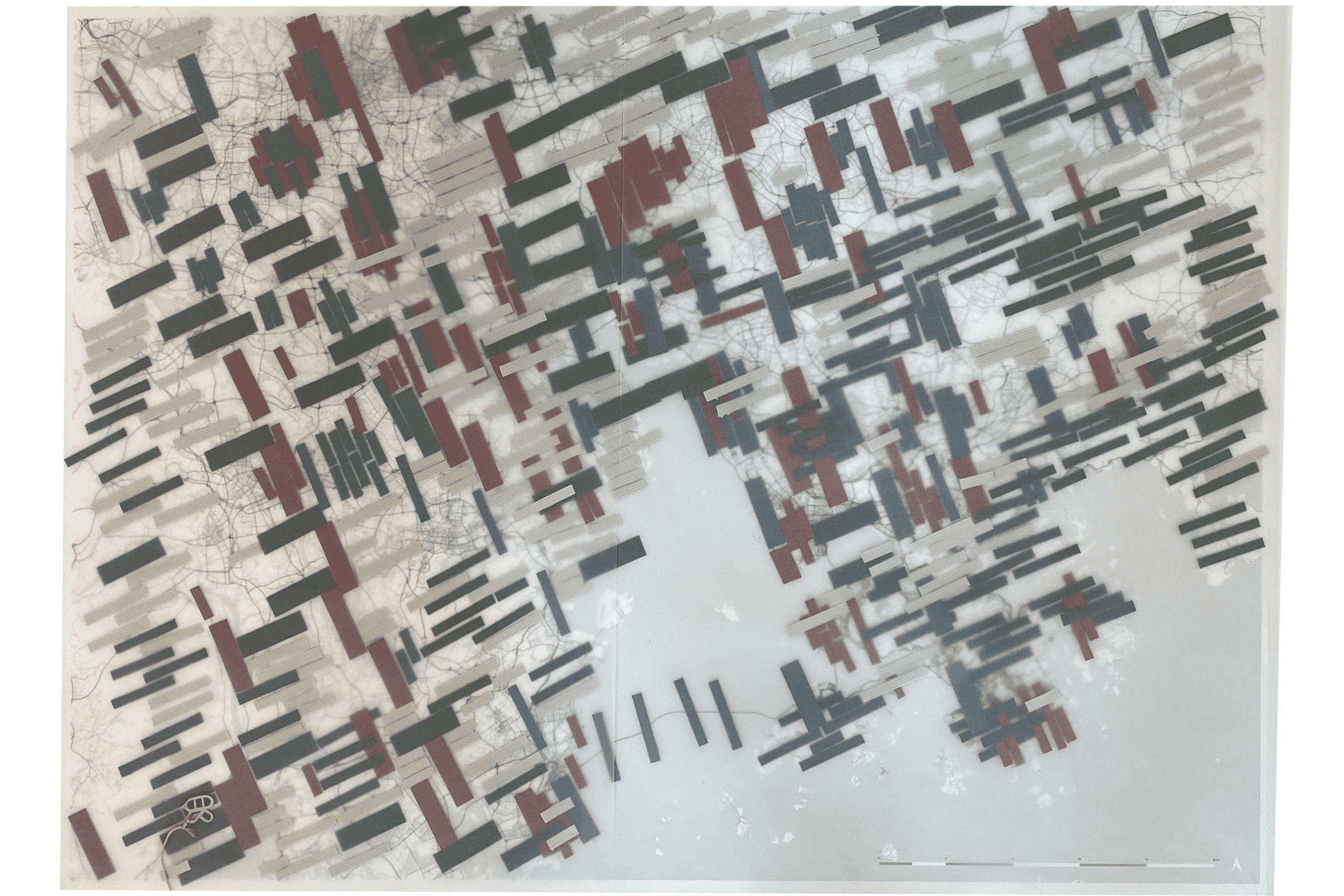
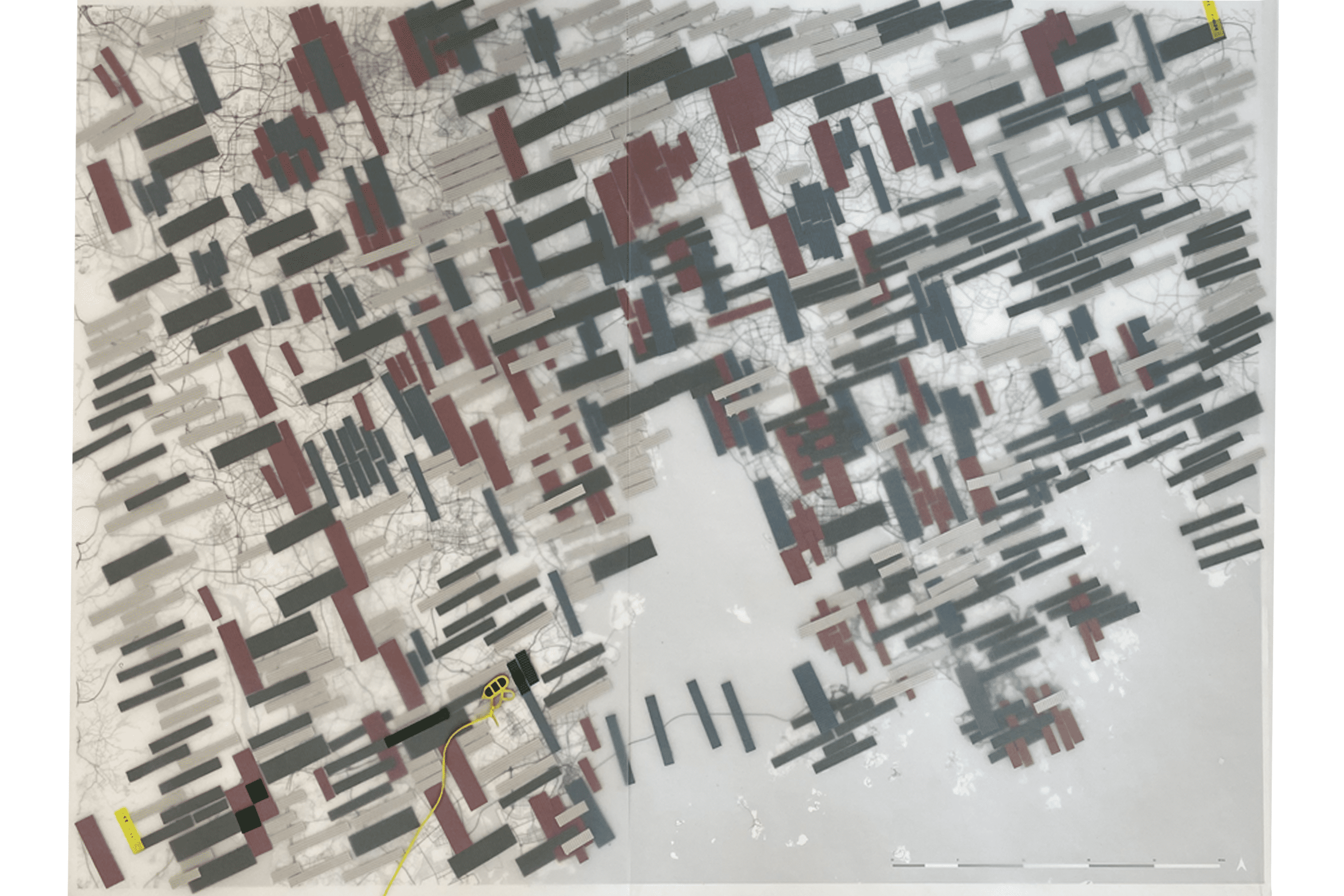
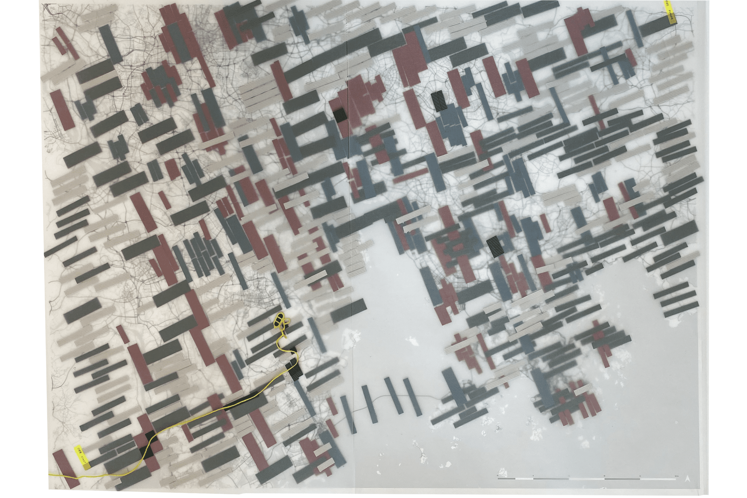
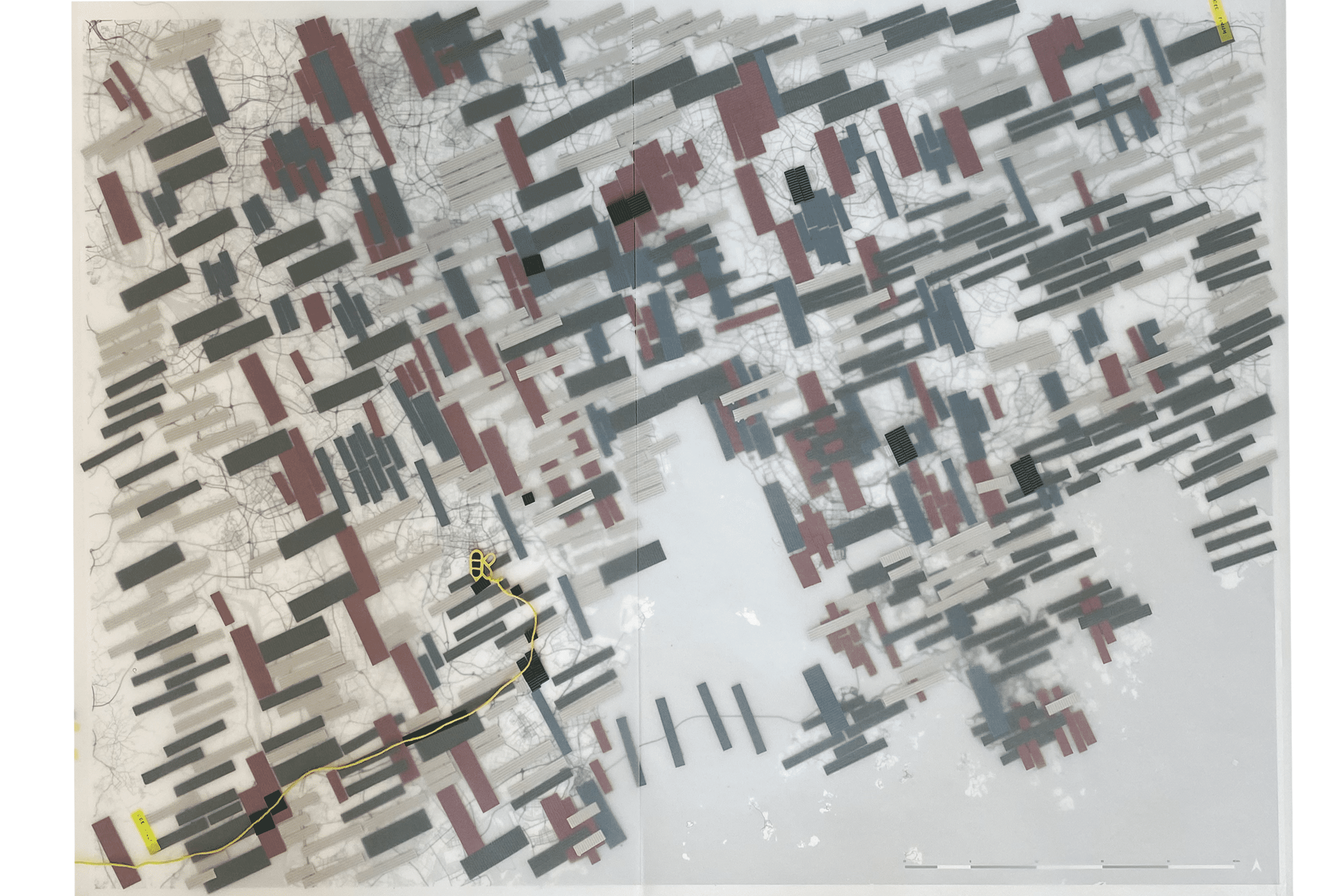
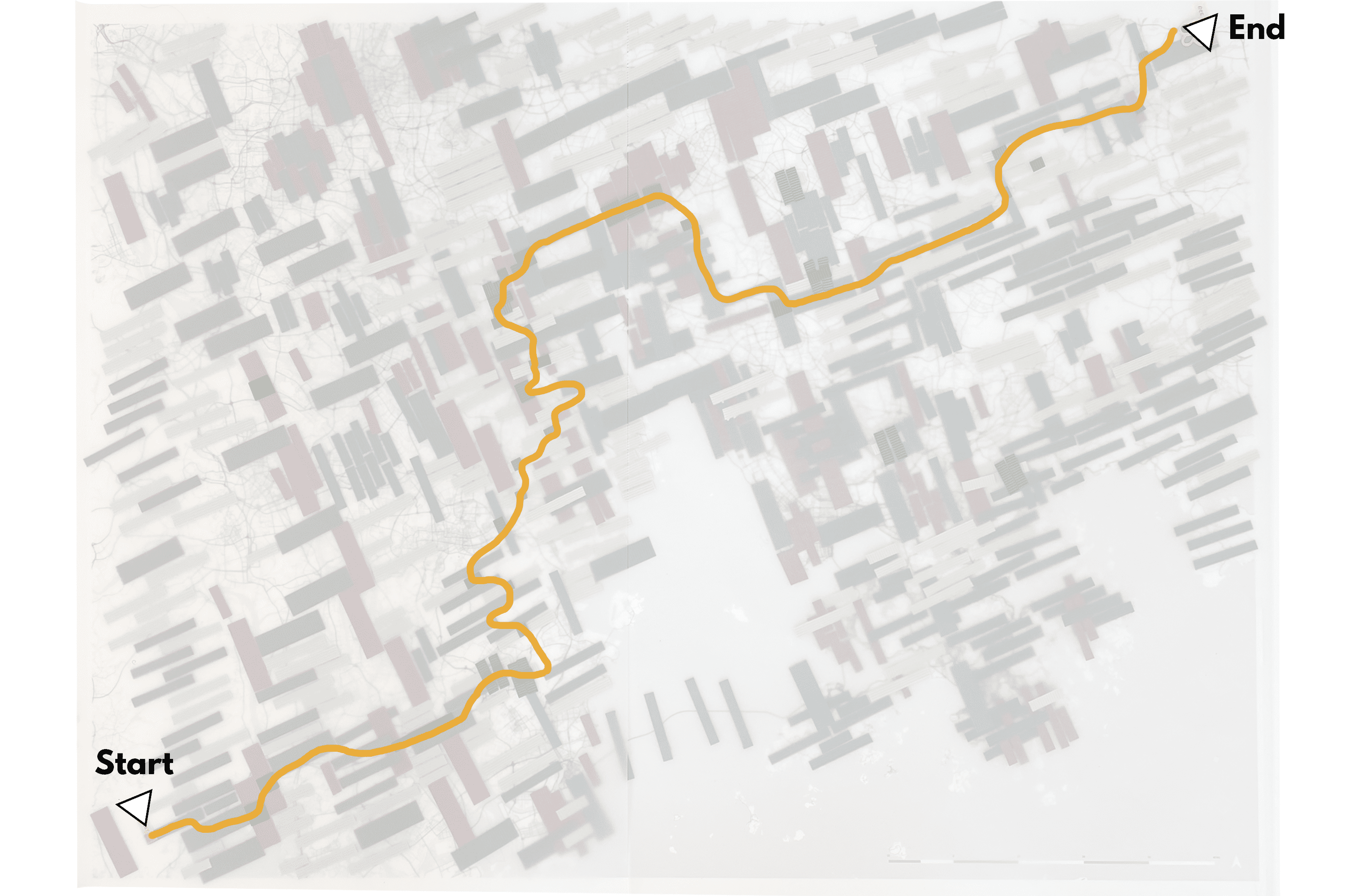
By defining the water as the main carrier of change, the highly sensitive delta condition becomes the backbone of the area that will set limits to urbanisation and exploitation. Through that, the seascape transforms from being a place of natural commodification to a defining spatial element with diverse and complex functionalities.

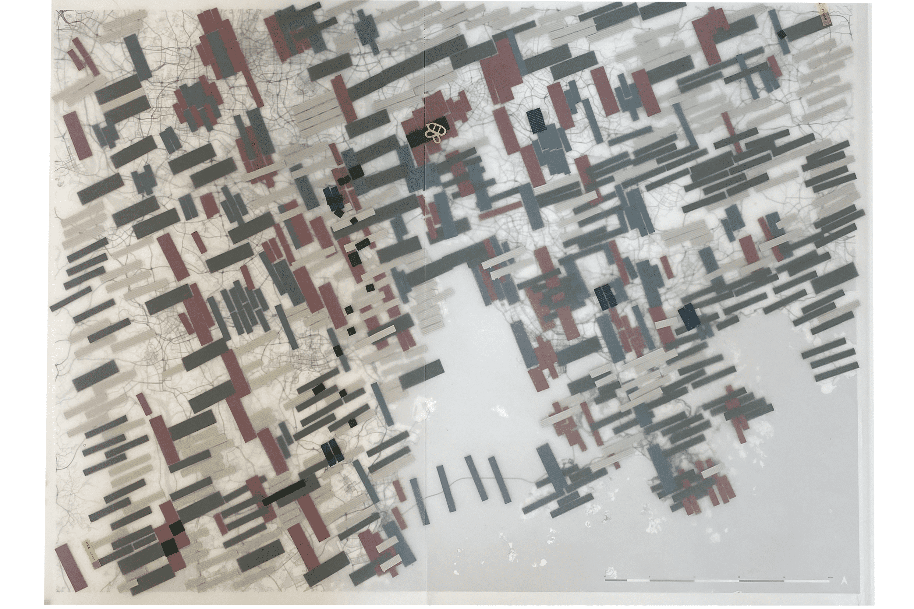
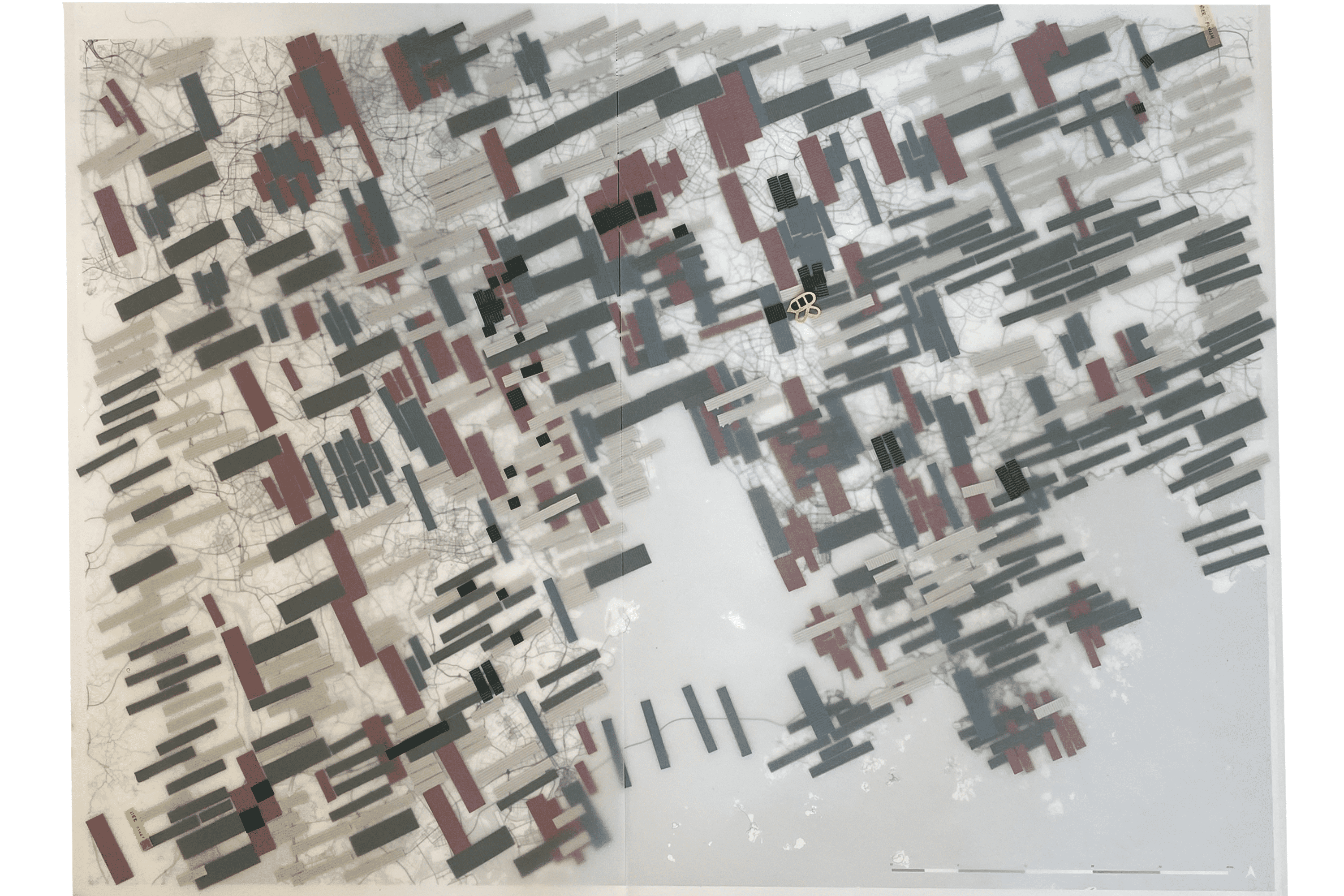
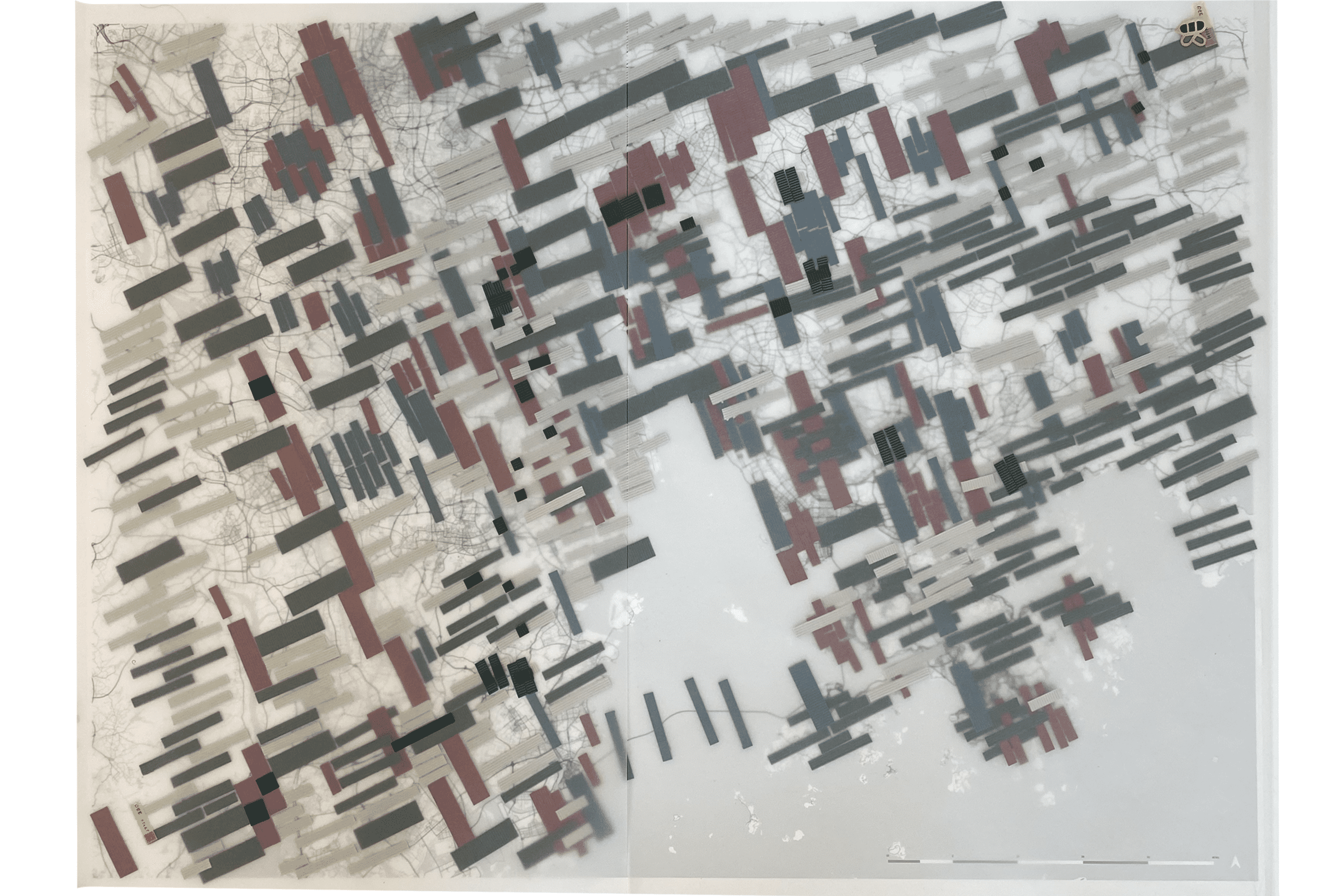
Multi-scalar green connections, as carriers of biodiversity, shall create a landscape continuum on different scales, manifested in main corridors which are branching into the urban fabric. By recuperating the capacities of the biophysical system on different scales, the newly gained balance can support the socio-economic development of the GBA.

A network among urban cores and sub-cores, as a carrier of collaboration, will diminish the vulnerability of the ecological and socio-economic systems. This will be reached by urban compaction through (re)distribution. During the process of taking away pressure from the highly-dense centres, forces are shifting to the peripheral areas. Retraining, supporting and strengthening the natural capacities which are present in these transition zones, will create an evolutionary resilience of the new system.


The Team

Anna Gorokhova is an indigenous Russian student who obtained her bachelor's degree in Landscape Architecture from the University of Hong Kong (2017) and currently continues her master's studies at TU Delft (2023). She has a great passion for indigenous and traditional cultural landscapes. She also possesses a great interest in design tackling climate vulnerability and urban regeneration.

Shiming Xu obtained her bachelor's degree in urban planning from Tongji University in China and is currently pursuing a master's degree in urbanism at TU Delft. Her undergraduate thesis explored innovative urban regeneration for a cross-border town of Hong Kong and Shenzhen. In this project, she continues her interest in the field of GBA and focuses on a multi-scale sustainable urban design approach in response to climate vulnerability.


Chuhan Zhang received her bachelor’s degree in landscape architecture at Huazhong University of Science and Technology and is continuing her master's study at TU Delft. More than 6 years of landscape study enriched her understanding of how the landscape could help with social and environmental issues. Having interests in water management and urban regeneration, she is seeking more possibilities to apply landscape knowledge to more practical use.

Emilie Stecher is an urbanism student at TU Delft who is very passionate about the urban and social challenges caused by the climate emergency. Looking at different scales of intervention, she seeks to create frameworks of adaptation and mitigation that grow out of the local conditions. By formulating design strategies to repair the planet and empower the voiceless parts of our society, she aspires to constitute the inevitable system change.


.

Ruta Vitkute grew up in Kaunas, Lithuania and received her bachelor’s degree in Architecture from VILNIUS TECH university. Two years of experience working as an urban designer and urban planner in Lithuania broadened her understanding of the importance and urgency of creating inclusive, resilient and bio-diverse cities for us and for future generations. She wishes to learn from the best practices abroad and later apply the knowledge in her home country.


Daniëlle Lens obtained her bachelor’s degree in Architecture and continued her master’s in Urban Design at the TU Delft. Her main interests lie with the socio-economic and spatial conditions that challenge the liveability and justice within complex cities across the globe. By participating in this challenge, she aims to broaden her knowledge and gain more insights into societal and environmental challenges in other parts of the world.


The Quest

Analysis of the corridors and patches

Loss of natural habitat

“Overall, urbanisation led to a decline in natural habitat, water retention, soil conservation, and carbon sequestration by 2.6%, 1.1%, 6%, and 3.4%, respectively. The relationship between urbanisation and ecosystem services was negatively correlated across the GBA; however, the relationship varied along urban-rural gradients, with the major part of ecosystem service degradation recorded in the early stage of urbanisation.”  

(Wang et al., 2020)

Analysis of the resource distribution

Imbalance in the distribution of resources

“To achieve a 30-minute city, cities need to put new jobs in housing rich-areas and new housing in job-rich areas systematically as a way of growing. This contrasts with local governments' desire to focus employment in the central city, and developers who will tend to put more housing in the outer suburbs where there are many fewer job.” 

(Levinson, 2019)

Analysis of the environmental risks

The need for a higher adaptive capacity

“Resilience or adaptive capacity is seen as embodied in the emergent properties of these socio-ecological systems. This means that resilience is not an asset but a process of change; ‘not [..] a being but [ . . .] a becoming’ (Davoudi, 2012a, p. 304). It is a concept that only actually attains performance after the system is confronted with disturbances and stresses. However, unlike other life forms, human beings can make conscious interventions into the process, and through such interventions, planned or otherwise, can diminish, sustain or enhance resilience. The latter should be the primary aim of any climate adaptation strategy.” 
(Davoudi et al., 2013)


The Challenge

How does the spatial configuration change if the dynamic deltaic system is given the capacity to respond to water-related risks?

How can the equal distribution of multi-scalar green connections support biodiversity and create healthy living environments in vulnerable neighbourhoods?

In what ways can the accessibility of the peripheral areas of second-tier cities be improved by applying a 30-minutes life-cycle and promoting collaboration within clusters?


The Game

Environmental risk and fragmentation

As a response to the analysis, the first game board and games were based on environmental risks and fragmentation. Four different coloured strips were made: blue for urban, green for nature, red for pollution and grey for exploitation. They were shaped according to their intensity, scale and difficulty to change, consequently, the bigger the strip, the more complex the condition is. On the basis of this, we could mark the most problematic areas in terms of environmental risk.


On top of that, we played a game in which we used the bee as a metaphor to see how easily species can travel through the region, which gave us insights into the fragmentation of the GBA. The conclusion could be drawn that the west side of the estuary is more urbanised. This, in combination with the estuary itself and the intense agriculture present, creates a border for biodiversity.

Initial gameboard


Stakeholders

In the next game, the stakeholders were the main drivers. Six stakeholders were appointed: developers, industrial companies, environmental activists, local inhabitants and the central government. Each role had distinct abilities and visions on the future of the GBA. The same game, with the bee, was played. By incorporating stakeholders into the game, decreasing fragmentation became much more difficult as economic growth was still the main viewpoint on the development in the region. Therefore, it took way longer to create a continuous corridor for the bee to cross the GBA.

Extreme scenario’s
In the last iterations, the focus was more on extreme scenarios, based on the four philosophical positions formulated by Clive Hamilton (2017): denialism, eco-modernism, posthumanism & anthropocentrism 2.0. For this iteration, every scenario built upon the previous scenario, leading up to a sequence of responses. After going through these different scenarios, we analysed the strengths of each position and combined them into our last iteration. We were able to define three main actions, which were prioritised in the following order: water as a backbone, green corridors and urban growth. From here on, we could start to formulate our vision for the GBA.

Four philosophical views on the anthropocene
 

The Vision

Vision map for the GBA

The GBA will be functioning as an evolutionary resilient system, growing and developing, over the upcoming years. This is a framework to improve human and natural well-being by and beyond 2030. A top-down approach for a complex green-blue network will be established that consists of local and regional interventions that synergize each other, with its green-blue heart at the centre of the region, in the estuary. The urban landscape will be reconfigured by implementing an extensive public transport network. Thereby, activating especially second-tier cities, together with the first-tier cities, will result in the formation of new clusters that are strengthened by their complementing sub-cores, together creating a stronger whole. By reaching further into the region with public transportation, current peripheries can be transformed into vibrant and compact neighbourhoods. On the neighbourhood scale, the fingers of the green-blue network will reach into the urban fabric by vegetating public transportation, public space and housing and allowing more room for the water. To empower the local population, the green-blue network and new functions that come paired with the compaction, allow new incentives and businesses that will help these places to thrive. Focusing on ecological restoration will create a more inclusive region that will be able to adapt to future challenges.
The strategic approach

To highlight the importance of the multi-scalarity in the vision, five different scales are taken into account: the province, the megaregion, the cluster, the city and the neighbourhood scale. Each scale provides important insights into how the scale responds to the three carriers of change. The three carriers of change are derived from the game board and form the basis of all interventions in the vision. Based on these 3 carriers, a toolbox with design principles has been drawn up to show the possibilities of the area. However, this toolbox gets its strength from all possible combinations of the principles adapted to the site and conditions in question. Therefore, to select the right principles, three milestones have been formulated: the evolutionary green-blue network, the bee festival and the 30 minutes life circle. The chosen milestones are not fixed, but dynamic. Therefore they allow disruptions and changes in the system as long as the system has enough adaptive capacity which is ensured by implementing the design principles.

Strategic and design principles
Vision of the province

Provincial scale
The vision has been drawn up from the scale of the GBA, but can be projected onto the whole province to align with the green and blue-way plan that is already established by the province of Guangdong. The green heart forms the central point from whereon the rivers and green corridors flow outwards, connecting existing natural areas. Public transportation and the coastline form important guidelines for the corridors. Furthermore, to redistribute the current pressure of development on the first-tier cities the hinterland will be activated by creating future perspectives for the local population and turning the secondary and third-tier cities into arrival cities.

Vision for the clusters of the GBA

 GBA clusters
In order to optimise the functionality of the megaregion, different clusters are formed that inhibit different identities. To allow the different clusters to benefit from each other, the connectivity between clusters is improved, especially through public transport. This strategy is based on the European principle that is becoming more prevalent: borrowed size, in which smaller cities are also able to thrive as they can borrow functionalities from bigger or other cities in the region. Furthermore, the concept is also used to free up space for nature.

Drawing on current trends, the Shenzhen-Hong Kong cluster will function as a global talent hub that drives innovation in the region. The Macao-Zhuhai-Zhongshan cluster will further expand as a leisure and tourism hotspot. Dongguan plays an important role in manufacturing and logistics and Guangzhou-Foshan will build upon its history and form the centre for culture and education. Besides the main clusters, three gateway cities are appointed: Jiangmen, Zhaoqin and Huizhou, which form the connection to the hinterland.

 
Vision for the estuary

Estuary
The estuary lies at the core of the region and will form the new green heart to establish the evolutionary green-blue network. Policies are put in place to stop the further urbanisation in the area. And the port will be moved out of the estuary, and as a consequence dredging can be stopped allowing more natural sedimentation. In order to decrease the risk of flooding, critical areas are appointed where the river has to be widened. Especially the river to the west of the estuary forms a risk. Agriculture is expected to go back to the traditional and sustainable forms like aquaculture, aquaponics and permaculture which can improve biodiversity. New mangrove forests, wetlands and nature-reserve zones are put in place to improve the water absorption and create softer edges between water and land. Instead of agriculture being a border between natural zones, it will now function as corridors benefiting the farmers as well as the insects, birds and animals travelling through.

Illustration of the green heart

Cluster scale
To further explain the functionality of the different clusters, we zoom further into Guangzhou-Foshan. Within the clusters, the ‘borrowed size’ principle is applied, but on a smaller scale. This means that on this scale it's not only about economic functionality, but mostly for the inhabitants to have access within a certain time to all their primary and secondary needs. This is where the 30-minute life circles come into place.

The 30 minutes life circles consist of three cycles. The local 30 minutes circle where people are able to have access to all primary needs and can travel towards the nearest public transportation within 30 minutes of walking or biking. The second cycle is from the nearest public transportation station to the main core of the city. The third cycle is from core to core, from Foshan to Guangzhou and visa-versa.

30-minutes life circles diagram
Vision for the city of Foshan

City scale
The second-tier city of Foshan is transformed by using the three carriers of change. The process starts by using the ‘water as a backbone’ to decrease the vulnerability of the area, widening the rivers and appointing flooding zones. On the basis of this, the first green corridors are formed along the waterways, creating wetlands and connecting existing green zones. Next, the new public transportation lines are introduced, partly functioning as green corridors as well. Through new means of transportation, peripheries become more accessible allowing compaction, which is done according to the vision and design principles in the toolbox. To show this in more detail, two parts of Foshan in the neighbourhood scale have been chosen: one showing the new compacted areas of the periphery between Foshan and the estuary and one closer to the city centre, applying the approach to the existing urban fabric. Both highlight opposite sides of the strategy: compaction and place-making.

The selected focus areas
Illustration of evolutionary green-blue network
Illustration of the revisited forms of agriculture

Neighbourhood scale: compaction
The first chosen area lies in the peripheries of Foshan and close to the green heart in the estuary and therefore forms the transition zone between the urban and natural areas. Agriculture, industry, housing and unused land are the most dominant land use. However, to reach the set goals the redistribution of these uses is needed.

Vision for the border between city and estuary

The first step is to give space to the water, widen the rivers in narrow locations that have a higher risk of flooding, and introduce more buffer zones, which consist of a variety of strategies by replanting mangroves and other forests, and adding purification areas and wetlands. The agriculture in the area will be transformed into aquaculture, aquaponics and permaculture to make it more resistant to flooding. Next, a new subway is introduced to connect the area to the city centre. The location of this stop is chosen strategically for the development of the sub-core. New road structures are introduced to improve connectivity and walkability. Existing elevated transportation networks are used for the green corridors, as they allow plants and flowers to grow underneath. Empty patches in between the roads and railways are used as new biodiversity patches. In the last step, the redistribution of the urban landscape becomes apparent, as the industrial zone shrinks slightly and shifts towards a more innovative instead of polluting industry. Unused land and fragmented agricultural zones are used for densification, to create a compact new sub-core. Different densification levels are introduced according to current urban fabrics and the distance to the stops. Different functions are introduced in the life circle to create a livable neighbourhood.

Ilulustration of the new forms of compaction

Neighbourhood scale: place-making
The second location is close to the Foshan train station and is relatively dense with a lot of urban and factory villages scattered around the fabric. This location is highlighted to show how the cores of second-tier cities can be strengthened through place-making. The first step was to analyse the current situation and indicate the most severe problems, which were water pollution and fragmented green. With the three carriers of change and milestones in mind, several important steps were taken.

Vision for the core of Foshan

The first intervention was the introduction of a water roundabout, augmenting the flow of the river. The roundabout is used to improve the flow of the water, avoiding still waters and to purify the water through the use of plants with a filtering capacity. The existing and expanded wetland plays an important role in this water purification. Additionally, empty spaces are used to widen the river to decrease the risk of flooding. To avoid further pollution of the rivers, a municipal waste treatment plant is installed which will collect wastewater from the sewage system to make the water reusable. Besides a green network, new bike lanes are introduced as well, promoting slow modes of transport and the use of public transportation, by also creating more space to stall bikes. 

The introduced changes are focusing on the public spaces, buildings and streets, as the municipality has the ability to change these conditions. The new spatial layout creates areas of intervention. Their proximity to urban or factory villages creates an opportunity to have a positive impact on them. By activating the public space and applying place-making principles, the strategic locations become triggers of change for the vulnerable neighbourhoods. This will result in a butterfly effect that has the potential to influence the villages in a positive way and create more healthy and liveable urban areas. 

Although certain tools are used, the approach doesn’t want to find solutions for the area but rather create the external conditions for change and empowerment of the citizens. The areas of intervention are potential locations for the bee festival which shall be used to create biodiversity hotspots that after the festival and over time form the basis of a green network. Furthermore, it shall promote local economic incentives and regeneration by co-creation of public space. The green network is based on the rule of a maximum of 200 metres (the distance a bee is able to see) between existing green areas, agriculture and the newly introduced biodiversity hotspots, the water system and wetlands. 

Section of the new distribution of networks
Illustration of the bee festival

Feedback loops

Feedback loops are built into the strategy in order to evaluate the evolutionary changes in the region. For each milestone, important measurable variables are selected that show the achieved progression. Through frequent evaluations, the strategy in specific areas, on a smaller or a larger scale, can be revised and altered to meet constantly changing needs and to ensure that the areas become and remain resilient

.

Diagram of the feedback loops

Evolutionary resilience in the GBA through the empowerment of traditions

The new interaction between city and estuary

By combining the European knowledge of cities and the traditions and culture of China, an inclusive and evolutionary vision has arisen. With a focus on the restoration of the biophysical systems and on the development of second-tier cities, the dynamic ECO-librium within the region is restored, refining the balance between humans and nature. The GBA has the power to evolve and respond to threats and changes, finding its way back to humility through the establishment of evolutionary resilience.

A recommendation for further research is to look into the way the first-tier cities can function according to this strategy. What does it mean for the existing cores in the region? The place-making strategy is a first attempt to start a dialogue between the new and the existing, but with shifting dynamics, new power relations will inevitably arise that have to be assessed, evaluated and guided.